At a glance
- Jan
- Feb
- Mar, under 5 mm of rain
- Apr, under 5 mm of rain
- May
- Jun, shaded
- Jul, shaded
- Aug, shaded
- Sep, shaded
- Oct
- Nov
- Dec
From few records: 5 records in 5 grid cells. The records.
Summary
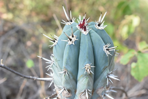
Pachycereus tepamo is a species of Pachycereus found in Mexico.
Quoted from Wikipedia, "Pachycereus tepamo", CC BY-SA 4.0.
About the genus · Pachycereus
Pachycereus is a genus of large cacti native to Central America and Mexico. They form large shrubs or small trees up to 15 m (49 ft) tall, with stout stems up to 1 m in diameter. Pachycereus comes from the ancient Greek παχύς meaning "thick" and the Latin cereus meaning "torch".
Quoted from Wikipedia, "Pachycereus", CC BY-SA 4.0.
Cultivation
Grouped as a cactus or succulent, listed under the genus Pachycereus in the archetype table, and Kew describes it as “succulent tree”.
Seasons
The rain rule reads a sharp season: 70% of the median year's rain (613 mm of 748 mm) falls in June to September. The temperature curve is flat, 3.6 °C between the warmest and coldest month, so the growing-season rule does not infer a growing season from it. Months are the habitat's, northern hemisphere. The temperature curve moves under 4 °C between the warmest and coldest month, where the shift rule does not apply, so they are not shifted for a collection elsewhere.
Rain
748 mm in the median year at the habitat, 613 mm of it June to September. Wettest month July at 170 mm, driest month April at 1 mm; 2 months under 5 mm. Across the grid cells of the range the year's total runs 645 mm to 834 mm, the 10th to 90th percentile of each cell's own year. The median of the cells' own yearly totals, 744 mm, is the year's rain at the top of the page; the 748 mm here is the median year's, the twelve monthly medians added, which the rain rule reads. Habitat calendar, northern hemisphere; median year across the grid cells of the range, CHELSA.
Light
Open sky over the habitat: 31 to 48 mol/m²/day across the year (daily light integral, median year across the grid cells of the range, CHELSA; the lowest 10th-percentile month across the cells is 30, the highest 90th-percentile month 48).
Warmth and air
Coldest: the 1st-percentile night over 44 years at a typical spot in the range is 15.4 °C, the absolute minimum 11.0 °C, no frost in 44 years (NASA POWER daily minima). Warmest: the 99th-percentile day is 41.7 °C. Monthly means: the coldest month's mean nightly low 18.3 °C in January (across the grid cells of the range 16.8 °C to 20.0 °C), the warmest month's mean daily high 35.9 °C in May (median year across the grid cells of the range, CHELSA). Cold floor: 15.4 °C, which is the 1st-percentile night over 44 years at a typical spot in the range (NASA POWER).
Relative humidity at the habitat: 47 to 65% across the year (monthly means, median year across the grid cells of the range, CHELSA). A figure about the air, saying nothing about how the plant takes water.
How this section is made
Each card states this species' habitat figures with their sources, and what two fixed rules read from them; nothing here says what the plant does, wants or tolerates. The rules · the terms.
Seasons. Read from the median year of CHELSA monthly rainfall and mean temperature across the grid cells of the range: the rain rule takes the smallest set of months carrying 70% of the rain and calls it winter when its mean is more than half a degree below the year's, summer when more than that above, and neither in between; the temperature rule, used only under 120 mm, names the cooler six months when they are at least a degree cooler than the other six. Months are shifted for the other hemisphere only where the temperature curve moves 4 °C or more and the habitat lies 10° or more from the equator. A reading of the curves, not an observation of the plant.
Rain. CHELSA monthly precipitation, median year across the grid cells of the range. The rain that falls where the species is recorded; nothing about how the plant takes water.
Light. CHELSA shortwave radiation at each envelope cell, a daily-mean flux taken to a daily total and converted at 2.07 mol of PAR per MJ. The sky over the habitat, measured; what reaches a plant under a rock, a shrub or a shade cloth is not.
Temperature. NASA POWER daily minima and maxima over 44 years at a typical spot in the range, lapse-corrected -342 m to its elevation; CHELSA monthly means, median year across the grid cells of the range. The cold floor is the 1st-percentile night named in its sentence. Not a measured survival limit for any plant in a pot.
Humidity. CHELSA relative humidity, median year across the grid cells of the range.
Group. Listed under the genus Pachycereus in the archetype table, and Kew describes it as “succulent tree”. A group is taken only where Kew's description of the species agrees with the table's listing. The table gives no figure and no prose; the cold floor is the habitat's alone.
Climate across the habitat
From few records: this habitat climate is read from 5 records in 5 grid cells; a page says so under 12 records or 5 cells, and shows the figures as read.
Habitat months, northern hemisphere
Mean daily high from 30 °C in Sep and Oct to 36 °C in Apr and May; mean nightly low from 18 °C in Jan to 23 °C in Jun, Jul, Aug, Sep and Oct. The cold quarter, Dec to Feb, is the three months around the coldest month's mean nightly low. 748 mm of rain in the median year (the twelve monthly medians added), the wettest month Jul. The bands show the 10th to 90th percentile across 5 habitat cells. Over 44 years at a typical spot in the range (NASA POWER) the absolute minimum was 11.0 °C and the 99th-percentile day 41.7 °C; neither is dated to a month. Beneath: daily light integral and relative humidity through the year, each on its own scale.
Figures by month
| Figure | Jan | Feb | Mar | Apr | May | Jun | Jul | Aug | Sep | Oct | Nov | Dec |
|---|---|---|---|---|---|---|---|---|---|---|---|---|
| Day °C | 31 / 30–33 | 33 / 31–34 | 34 / 33–36 | 36 / 35–38 | 36 / 35–38 | 33 / 32–35 | 32 / 30–33 | 31 / 30–33 | 30 / 29–32 | 30 / 29–32 | 31 / 30–33 | 31 / 30–33 |
| Night °C | 18 / 17–20 | 19 / 17–20 | 19 / 18–20 | 21 / 19–22 | 22 / 21–23 | 23 / 22–25 | 23 / 22–24 | 23 / 22–24 | 23 / 21–24 | 23 / 21–23 | 21 / 19–22 | 19 / 18–21 |
| Rain mm | 23 / 15–28 | 9 / 7–10 | 3 / 3–4 | 1 | 15 / 12–16 | 125 / 97–152 | 170 / 136–199 | 164 / 129–185 | 154 / 140–173 | 66 / 64–75 | 13 / 11–16 | 5 / 4–6 |
| DLI | 32 / 32–33 | 38 / 37–39 | 44 / 44–45 | 48 / 47–48 | 46 / 46–47 | 38 / 36–39 | 37 / 34–38 | 36 / 33–38 | 32 / 30–34 | 32 / 31–33 | 32 / 32–33 | 31 / 30–32 |
| RH % | 53 / 48–56 | 51 / 46–55 | 49 / 45–54 | 47 / 43–52 | 50 / 46–53 | 59 / 55–61 | 62 / 58–65 | 63 / 58–66 | 65 / 61–68 | 64 / 59–66 | 59 / 54–60 | 55 / 50–57 |
How this section is made
Natural habitat
How this section is made
Related
Similar habitat climate The 6 nearest by mean daily high, mean nightly low and rain, month by month. How.
 Ferocactus lindsayi Cactaceae Photo: CC BY, P Gonzalez Zamora Oehmea beneckei Cactaceae Agave infiernilloensis Asparagaceae
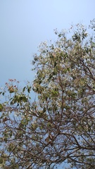 Cordia elaeagnoides Cordiaceae Photo: CC BY, Carlos Domínguez-Rodríguez
 Pinguicula colimensis Lentibulariaceae Photo: CC BY, P Gonzalez Zamora
Other Pachycereus 5 in the reference
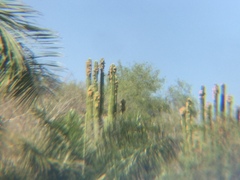 Pachycereus grandis Cactaceae Photo: CC BY, Erick Vélez Sánchez
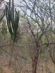 Pachycereus pecten-aboriginum Indian Comb Photo: CC BY, Xavier Alejandro Caratachea Navarro
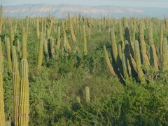 Pachycereus pringlei Cardón Cactus Photo: CC BY, Jose Luis Leon de la Luz
 Pachycereus schottii Senita Cactus Photo: CC BY, Sula Vanderplank
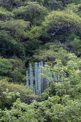 Pachycereus weberi Cactaceae Photo: CC BY, José Javier Barrios Flores
Names & registers
The record
Every figure here is derived from public data by a stated rule and names its source; nothing about this species is written for its page by a person or by AI, apart from the marked, credited quotations. How →
Where this page came from built 2026-10-22
gbif.species answeredasked 2026-10-22gbif.synonyms answeredasked 2026-10-22gbif.vernacular answeredasked 2026-10-22names fetched 2026-10-22wcvp.distribution answeredas of 2026-06-04gbif.occurrences answeredas of 2026-10-21GBIF occurrence download https://doi.org/10.15468/dl.hbdw64, of 2026-10-21climate answeredasked 2026-10-22climate.extremes answeredasked 2026-10-22NASA POWER (MERRA-2) daily 1981–2024, cell 18.50_-101.250, lapse-corrected -342 m at 6.5 °C/kmwikidata answeredasked 2026-10-22IPNI and POWO linked by Kew's number for Pachycereus tepamo Gama & S.Arias (the item's: IPNI 1005318-1, POWO 317107-2)wikipedia answeredasked 2026-10-22inat.photos.wild answeredasked 2026-10-22from iNaturalist's open data of 2026-09-27: research-grade observations with an open-licence photograph, the 24 whose photographs iNaturalist received last (the open data holds no votes); filled 2026-10-22inat.photos.cultivated not askedgbif.media nothing to reportasked 2026-10-22commons nothing to reportasked 2026-10-22openalex not askednot yet asked for this reference; a later fill takes the papers from OpenAlex's snapshotEvery source is recorded as having answered, reported nothing, refused, failed, not been asked, or answered twice where one answer is taken (“not taken: two items answered”), and, for a source asked when this page was built, when: the figures are as the source held them that day; a source read from a file (Kew's World Checklist, a GBIF download) says "as of" the file's day instead; a row carried from an earlier build of the page names that build instead. Only “nothing to report” is ever shown as an absence. Records came from 4 datasets via GBIF.org; each carries its own licence.