Asteraceae › Solidago › 47 of 66
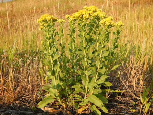
Solidago rigida L.
Stiff goldenrod; Rigid goldenrod; Stiff-leaved goldenrod; Stiff-leaf goldenrod
| Family | Asteraceae |
|---|---|
| Native to | Alberta, Manitoba, Saskatchewan, Ontario, Colorado, Montana, Wyoming, Illinois, Iowa, Kansas, Minnesota, Missouri, North Dakota, Nebraska, Oklahoma, South Dakota, Wisconsin, Connecticut, Indiana, Massachusetts, Michigan, New Jersey, New York, Ohio, Pennsylvania, Rhode I., West Virginia, New Mexico, Texas, Alabama, Arkansas, Delaware, Georgia, Kentucky, Louisiana, Maryland, Mississippi, North Carolina, South Carolina, Tennessee, Virginia · Kew's World Checklist, file of 2026-06-04 |
| Your plants | Add one · related species |
Asteraceae · Alberta +40
Also called Rigid goldenrod; Stiff-leaved goldenrod; Stiff-leaf goldenrod
Family Asteraceae
Native to Alberta, Manitoba, Saskatchewan, Ontario, Colorado, Montana, Wyoming, Illinois, Iowa, Kansas, Minnesota, Missouri, North Dakota, Nebraska, Oklahoma, South Dakota, Wisconsin, Connecticut, Indiana, Massachusetts, Michigan, New Jersey, New York, Ohio, Pennsylvania, Rhode I., West Virginia, New Mexico, Texas, Alabama, Arkansas, Delaware, Georgia, Kentucky, Louisiana, Maryland, Mississippi, North Carolina, South Carolina, Tennessee, Virginia
Habitat in shortFigures ›
- Cold floor
- -25.4 °C 1 night in 100 colder NASA POWER
- Rain
- 892 mm a year, median across the range CHELSA
- Open-sky light
- 10–41 DLI lowest to highest month CHELSA
- Season
- Wet summers Apr–Oct, your months CHELSA
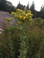


 99 photographs ›
At a glance
- Jan
- Feb
- Mar
- Apr, shaded
- May, shaded
- Jun, shaded
- Jul, shaded
- Aug, shaded
- Sep, shaded
- Oct, shaded
- Nov
- Dec
Hardiness of the habitat
| USDA zone of the habitat | 4b | the mean of the typical spot’s lowest night in each of 44 complete years, 1981–2024: −29.4 °C = −29.4 × 9 ÷ 5 + 32 = −20.92 °F, in zone 4b (−25 to −20 °F). USDA’s zones are the 30-year mean of each year’s lowest temperature, in 10 °F zones with 5 °F half-zones (USDA Plant Hardiness Zone Map); this mean is of the years the series holds, not USDA’s 1991–2020. |
|---|---|---|
| RHS band of the record low | H7 | the record low falls in RHS’s H7 band (colder than −20 °C: very hardy; RHS hardiness rating): −44.6 °C, the lowest night in 44 years. |
Both are the habitat’s, worked out from where it grows wild: neither is a tested hardiness of the plant. Lows from NASA POWER (MERRA-2) daily 1981–2024, cell 47.00_-111.250, lapse-corrected -40 m at 6.5 °C/km.
Climate class
Dfa Köppen–Geiger, worked out from the median year of the range’s 1583 cells
| D cold | the coldest month −5.4 °C, 0 °C or under; the warmest 22.7 °C, over 10 °C; not arid: 853 mm a year, 10 × 32.0 mm (2 × 9.0 + 14: 67% of the rain in summer and 33% in winter, neither 70% or more) or more |
|---|---|
| f without dry season | neither: the driest summer month 82 mm against the wettest winter month's 71 mm, the driest winter month 28 mm against the wettest summer month's 110 mm (summer April to September) |
| a hot summer | the warmest month 22.7 °C, 22 °C or more |
By the thresholds of Peel, Finlayson and McMahon (2007), Hydrology and Earth System Sciences 11, 1633–1644, Table 1; summer is the warmer of October to March and April to September. The class of the median year, each month’s median across the cells, not of each cell.
Walter–Lieth: no arid month: every month’s rain in mm is at least twice its mean temperature in °C. The scale of Walter and Lieth’s climate diagrams (1960–1967), 10 °C to 20 mm.
The months read: CHELSA V2.1 1981–2010 climatology, 0.05° cells (each the mean of ~36 1 km pixels).
At home, aim for (worked out from the figures above)
| Winter nights | -16–-4 °C | the January mean nightly low, 10th to 90th percentile across the 1,583 cells of the range, median -9.4 °C (CHELSA V2.1, 1981–2010); its coldest night on record was -44.6 °C (NASA POWER, daily lows over 44 years at the typical spot) |
|---|---|---|
| Summer days | 25–32 °C | the July mean daily high, 10th to 90th percentile across the 1,583 cells of the range, median 27.8 °C (CHELSA V2.1, 1981–2010) |
| Grow light, 14 h a day | 518 µmol/m²/s | the year’s mean daily light, 26.1 mol/m²/day (the twelve monthly medians averaged; open sky, CHELSA V2.1, 1981–2010 solar radiation at 2.07 mol of PAR per MJ), × 1,000,000 ÷ (14 × 3,600) |
| Humidity | 55–62% | the lowest and highest of the twelve monthly median relative humidities (CHELSA V2.1, 1981–2010); a figure about the air, saying nothing of how the plant takes water |
A starting point worked out from where it grows wild, not tested in cultivation. The light is the open sky’s; a plant among rocks or shrubs gets less.
Summary
Solidago rigida, known by the common names stiff goldenrod and stiff-leaved goldenrod, is a North American plant species in the family Asteraceae. It has a widespread distribution in Canada and the United States, where it is found primarily east of the Rocky Mountains. It is typically found in open, dry areas associated with calcareous or sandy soil. Habitats include prairies, savannas, and glades.
Quoted from Wikipedia, "Solidago rigida", its opening paragraph, revision 1306463929, read 2026-11-08, CC BY-SA 4.0.
About the genus · Solidago
Solidago, commonly called goldenrod, is a genus of about 100 to 120 species of flowering plants in the family Asteraceae. Most are herbaceous perennial species found in open areas such as meadows, prairies, and savannas. They are mostly native to North America, including Mexico; a few species are native to South America and Eurasia. More on Wikipedia ›
Quoted from Wikipedia, "Solidago", its opening paragraph, revision 1378030232, read 2026-11-08, CC BY-SA 4.0.
Cultivation
Seasons
The rain rule reads a summer growing season: 70% of the median year's rain (645 mm of 853 mm) falls in April to October, warmer than the year (wet-season mean 16.4 °C against a yearly mean of 9.0 °C). Months are the habitat's, northern hemisphere; shifted six months for a southern-hemisphere collection: October to April.
Rain
853 mm in the median year at the habitat, 645 mm of it April to October. Wettest month June at 110 mm, driest month January at 28 mm. Across the grid cells of the range the year's total runs 497 mm to 1,125 mm, the 10th to 90th percentile of each cell's own year. The median of the cells' own yearly totals, 892 mm, is the year's rain at the top of the page; the 853 mm here is the median year's, the twelve monthly medians added, which the rain rule reads. Habitat calendar, northern hemisphere; median year across the grid cells of the range, CHELSA.
Light
Open sky over the habitat: 10 to 41 mol/m²/day across the year (daily light integral, median year across the grid cells of the range, CHELSA; the lowest 10th-percentile month across the cells is 8, the highest 90th-percentile month 44).
Warmth and air
Coldest: the 1st-percentile night over 44 years at a typical spot in the range is -25.4 °C, the absolute minimum -44.6 °C, 8,628 frost nights in 44 years, 196.1 a year (NASA POWER daily minima). Warmest: the 99th-percentile day is 32.5 °C. Monthly means: the coldest month's mean nightly low -9.4 °C in January (across the grid cells of the range -15.6 °C to -3.5 °C), the warmest month's mean daily high 27.8 °C in July (median year across the grid cells of the range, CHELSA). Cold floor: -25.4 °C, which is the 1st-percentile night over 44 years at a typical spot in the range (NASA POWER).
Relative humidity at the habitat: 55 to 62% across the year (monthly means, median year across the grid cells of the range, CHELSA). A figure about the air, saying nothing about how the plant takes water.
How this section is made
Each card states this species' habitat figures with their sources, and what two fixed rules read from them; nothing here says what the plant does, wants or tolerates. The rules · the terms.
Seasons. Read from the median year of CHELSA monthly rainfall and mean temperature across the grid cells of the range: the rain rule takes the smallest set of months carrying 70% of the rain and calls it winter when its mean is more than half a degree below the year's, summer when more than that above, and neither in between; the temperature rule, used only under 120 mm, names the cooler six months when they are at least a degree cooler than the other six. Months are shifted for the other hemisphere only where the temperature curve moves 4 °C or more and the habitat lies 10° or more from the equator. A reading of the curves, not an observation of the plant.
Rain. CHELSA monthly precipitation, median year across the grid cells of the range. The rain that falls where the species is recorded; nothing about how the plant takes water.
Light. CHELSA shortwave radiation at each envelope cell, a daily-mean flux taken to a daily total and converted at 2.07 mol of PAR per MJ. The sky over the habitat, measured; what reaches a plant under a rock, a shrub or a shade cloth is not.
Temperature. NASA POWER daily minima and maxima over 44 years at a typical spot in the range, lapse-corrected -40 m to its elevation; CHELSA monthly means, median year across the grid cells of the range. The cold floor is the 1st-percentile night named in its sentence. Not a measured survival limit for any plant in a pot.
Humidity. CHELSA relative humidity, median year across the grid cells of the range.
Climate across the habitat
Habitat months, northern hemisphere
Mean daily high from -1 °C in Jan to 28 °C in Jul; mean nightly low from -9 °C in Jan to 18 °C in Jul and Aug. The cold quarter, Dec to Feb, is the three months around the coldest month's mean nightly low. 853 mm of rain in the median year (the twelve monthly medians added), the wettest month Jun. The bands show the 10th to 90th percentile across 1583 habitat cells. Over 44 years at a typical spot in the range (NASA POWER) the absolute minimum was -44.6 °C and the 1-in-100 hot day (the 99th-percentile day) 32.5 °C; neither is dated to a month. Beneath: daily light integral and relative humidity through the year, each on its own scale.
Figures by month
| Month | Day °C | Night °C | Rain mm | DLI | RH % |
|---|---|---|---|---|---|
| Jan | −1 / −7–6 | −9 / −16–−4 | 28 / 14–70 | 13 / 10–16 | 62 / 57–68 |
| Feb | 1 / −4–9 | −8 / −13–−2 | 33 / 14–67 | 19 / 17–22 | 60 / 57–65 |
| Mar | 7 / 3–14 | −3 / −7–3 | 52 / 26–91 | 26 / 25–29 | 57 / 55–61 |
| Apr | 14 / 11–20 | 4 / −1–8 | 82 / 31–104 | 33 / 32–36 | 55 / 53–56 |
| May | 20 / 17–24 | 10 / 6–14 | 99 / 65–133 | 37 / 37–39 | 56 / 54–58 |
| Jun | 25 / 22–29 | 16 / 11–19 | 110 / 82–129 | 41 / 39–43 | 57 / 55–59 |
| Jul | 28 / 25–32 | 18 / 15–22 | 101 / 68–117 | 40 / 39–44 | 58 / 54–59 |
| Aug | 27 / 25–31 | 18 / 14–21 | 95 / 56–119 | 35 / 34–39 | 59 / 54–60 |
| Sep | 22 / 19–27 | 13 / 9–17 | 87 / 44–102 | 28 / 25–32 | 58 / 54–59 |
| Oct | 15 / 11–20 | 7 / 2–10 | 71 / 36–95 | 19 / 16–23 | 57 / 55–59 |
| Nov | 8 / 2–13 | 0 / −6–5 | 57 / 19–93 | 12 / 10–17 | 59 / 57–62 |
| Dec | 1 / −5–7 | −7 / −13–−1 | 38 / 16–80 | 10 / 8–14 | 62 / 58–67 |
How this section is made
Natural habitat
Flowering by month
- 0Jan
- 0Feb
- 0Mar
- 0Apr
- 0May
- 2Jun
- 52Jul
- 310Aug
- 351Sep
- 30Oct
- 1Nov
- 0Dec
Flowering observations of wild plants on iNaturalist, as iNaturalist shares them with GBIF: GBIF.org (2026-11-15) GBIF Occurrence Download https://doi.org/10.15468/dl.y8zpkp: 746 observations, research grade, openly licensed (CC0, CC BY or CC BY-NC), counted under the page's GBIF keys. Calendar months, as each plant was observed; not moved to your hemisphere.
How this section is made
Photographs
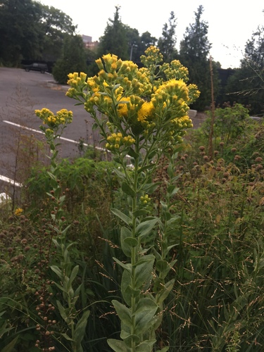
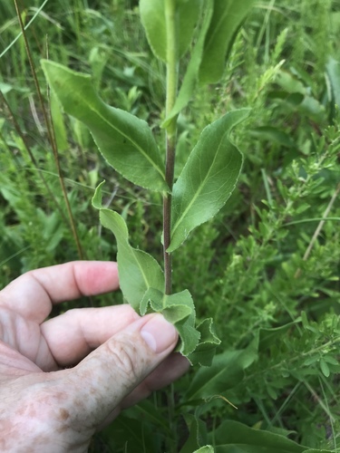
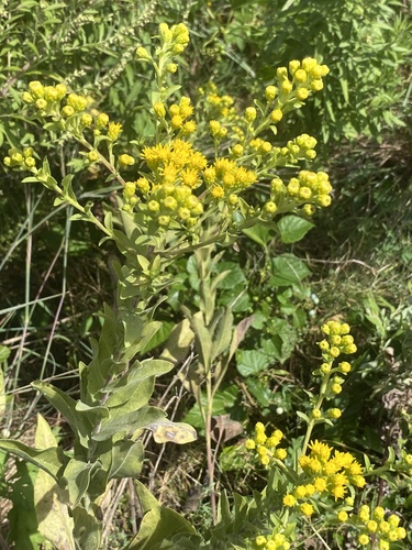
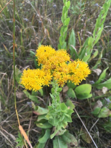
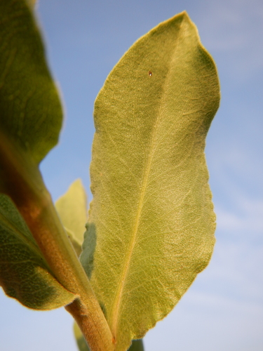
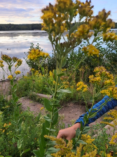
The photograph at the top: (c) Matt Lavin, some rights reserved (CC BY), observed growing wild, observed 2014-08-03. Photographs: Daniel Atha, no rights reserved (CC0); Alan Weakley, no rights reserved (CC0); (c) Sandy Wolkenberg, some rights reserved (CC BY); (c) harrier, some rights reserved (CC BY); (c) Matt Lavin, some rights reserved (CC BY); Rita Shaw, no rights reserved (CC0). Credits as read from iNaturalist on 2026-11-04. What each licence allows.
Related
Similar habitat climate The 6 nearest by mean daily high, mean nightly low and rain, month by month. How.
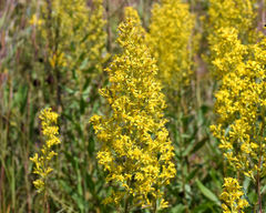 Solidago rigidiuscula Stiff-leaved showy goldenrod Photo: CC BY-SA, davecz2
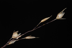 Sporobolus heterolepis Prairie dropseed Photo: CC BY-SA, Douglas Goldman
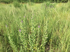 Verbena stricta Hoary vervain Photo: CC BY, Derek
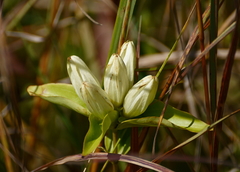 Gentiana alba Gentianaceae Photo: CC BY-SA, psweet
 Veronica bullii Plantaginaceae Photo: CC BY, Ryan Sorrells
 Amorpha canescens Leadplant Photo: CC BY, Matt Lavin
Other Solidago 65 in the reference
 Solidago altissima Tall goldenrod Photo: CC BY, Jay Pruett
 Solidago arguta Atlantic goldenrod Photo: CC BY, Michael J. Papay
 Solidago bicolor White goldenrod Photo: CC BY, Katja Schulz
 Solidago buckleyi Buckley's goldenrod Photo: CC BY, Dominic
 Solidago caesia Wreath goldenrod Photo: CC BY, Randy A Nonenmacher
 Solidago canadensis Canada goldenrod Photo: CC BY, Андрей Козлов
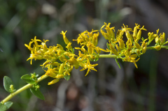 Solidago chapmanii Chapman's Goldenrod Photo: CC BY-SA, James (Jim) Duggan
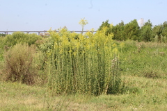 Solidago chilensis Anise Goldenrod Photo: CC0, demianlescano
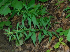 Solidago curtisii Mountain decumbent goldenrod Photo: CC BY, Michael J. Papay
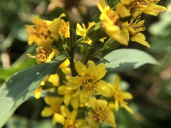 Solidago decurrens Asteraceae Photo: CC BY, 黃美滿
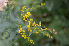 Solidago drummondii Drummond's goldenrod Photo: CC0, stlmark
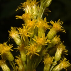 Solidago elongata West coast goldenrod Photo: CC BY, Gabriel Campbell-Martinez all 66 ›
Names & registers
WFO Plant List (2026-06) accepted. World Flora Online, CC0; read 2026-11-13.
Published in Sp. Pl.: 880 (1753) (WCVP, RBG Kew, file of 2026-06-04)
Elsewhere Tropicos · Catalogue of Life · Flora of North America · Missouri Plant Finder · CalPhotos · EOL · ITIS · NCBI (identifiers from Wikidata's item Q15568528, read 2026-11-13, CC0)
Chromosomes n = 18 (Parfitt & Harriman 1981). ChromoDB, IAPT/IOPB chromosome data (Simon, Bosch & Blanché), version 3.1 of 8 November 2026, CC BY 4.0; read 2026-11-13.
The record
Predicted extinction risk 1% probability of being threatened (95% interval 1% to 2%); predicted not threatened, the model is confident of this class. A model's prediction, not an assessment. Bachman et al. 2024, New Phytologist; Kew's data of 1 February 2024, CC BY 4.0; read 2026-11-13.
CITES Not in the CITES Appendices (the edition in force from 5 March 2026): no listing of its name, its genus or its family. CITES Appendices I, II and III, valid from 5 March 2026; read 2026-11-13. The Appendices
Every figure here is derived from public data by a stated rule and names its source; nothing about this species is written for its page by a person or by AI, apart from the marked, credited quotations. How →
Where this page came from built 2026-11-18
gbif.species answeredkept from this page's build of 2026-11-01gbif.synonyms answeredkept from this page's build of 2026-11-01gbif.vernacular answeredasked 2026-11-18names fetched 2026-10-22; carried by an offline re-derivation of 2026-11-18wcvp.distribution answeredas of 2026-06-04gbif.occurrences answeredas of 2026-10-21GBIF occurrence download https://doi.org/10.15468/dl.hbdw64, of 2026-10-21; 1 record at a dataset's default point left out (a coordinate where the records of 20 species or more of this reference lie, nearly all of them with no year, as the reference lists them; a record there its dataset states to within 10 km is kept); records tested against the native regions' shapes, openly licensed and restricted alike (Natural Earth's provinces, placed in TDWG's regions; shapes rule r87); a record within the margin, off a coast or on an island too small to draw counted only when it states the region's country, and only on no other region's land but within 0.02° of a native shape across a border, where its stated state or province does not name the other region (read by Natural Earth's name, its ISO 3166-2 code or an old province's name); 40 records within 1 km of a botanic garden, herbarium or zoo left out (31 at a botanic garden or arboretum, 3 at a herbarium, 6 at a zoo; Wikidata's list)climate answeredasked 2026-11-18climate.extremes answeredasked 2026-11-18NASA POWER (MERRA-2) daily 1981–2024, cell 47.00_-111.250, lapse-corrected -40 m at 6.5 °C/kmwikidata answeredkept from this page's build of 2026-10-22wikipedia answeredkept from this page's build of 2026-10-22; not asked againinat.taxon answerediNaturalist's taxon 125721 (Solidago rigida), kept from an earlier build, checked 2026-10-23: active and this species' own (kept from this page's build of 2026-10-22)inat.photos.wild answeredasked 2026-10-26from iNaturalist's API: research-grade observations not marked captive with an open-licence photograph, the observations iNaturalist puts first by votes, 24 of them (the open data of 2026-09-27 holds 1101, and no votes); filled 2026-10-26; descendants read against Kew's file of 2026-06-04; kept by the build of 2026-11-18 (this build: not asked: this build left iNaturalist to the daily fill, which asks for the photographs once the page's taxon is known)inat.photos.cultivated answeredasked 2026-10-26observations marked captive or cultivated whose identifications agree; filled 2026-10-26; kept by the build of 2026-11-18 (this build: not asked: this build left iNaturalist to the daily fill, which asks for the photographs once the page's taxon is known)gbif.media answeredas of 2026-10-21from the GBIF download https://doi.org/10.15468/dl.hbdw64, of 2026-10-21commons not askedkept from this page's build of 2026-10-29openalex not askedthe reference does not ask OpenAlex for papersEvery source is recorded as having answered, reported nothing, refused, failed, not been asked, or answered twice where one answer is taken (“not taken: two items answered”), and, for a source asked when this page was built, when: the figures are as the source held them that day; a source read from a file (Kew's World Checklist, a GBIF download) says "as of" the file's day instead; a row carried from an earlier build of the page names that build instead. Only “nothing to report” is ever shown as an absence. Records came from 84 datasets via GBIF.org; each carries its own licence.