Hypericaceae › Hypericum › 80 of 107
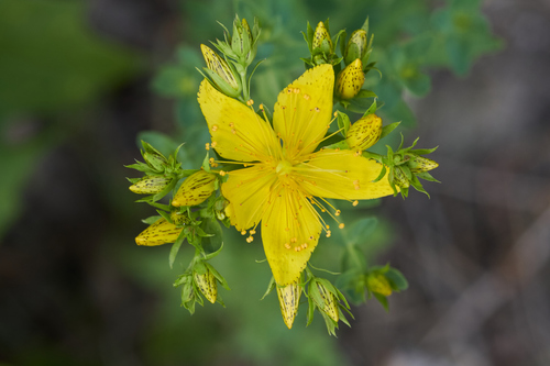
Hypericum perforatum L.
Common St. John's wort; Klamath weed; Perforate St John's-wort; Perforate St. John's-wort
Also called Hypericum perforatum f. floribundum.
| Family | Hypericaceae |
|---|---|
| Native to | Denmark, Finland, Great Britain, Ireland, Norway, Sweden, Austria, Belgium, Czechoslovakia, Germany, Netherlands, Poland, Switzerland, France, Portugal, Spain, Albania, Bulgaria, Greece, Italy, Romania, Yugoslavia, Belarus, Baltic States, Krym, Central European Russia, East European Russia, South European Russia, Northwest European Russia, Ukraine, Morocco, Altay, Krasnoyarsk, West Siberia, Kazakhstan, Kirgizistan, North Caucasus, Cyprus, East Aegean Is., Lebanon-Syria, Turkey, China South-Central, China North-Central, Qinghai, China Southeast, Xinjiang · Kew's World Checklist, file of 2026-06-04 |
| Your plants | Add one · related species |
Hypericaceae · Denmark +45
Also called Klamath weed; Perforate St John's-wort; Perforate St. John's-wort
Family Hypericaceae
Native to Denmark, Finland, Great Britain, Ireland, Norway, Sweden, Austria, Belgium, Czechoslovakia, Germany, Netherlands, Poland, Switzerland, France, Portugal, Spain, Albania, Bulgaria, Greece, Italy, Romania, Yugoslavia, Belarus, Baltic States, Krym, Central European Russia, East European Russia, South European Russia, Northwest European Russia, Ukraine, Morocco, Altay, Krasnoyarsk, West Siberia, Kazakhstan, Kirgizistan, North Caucasus, Cyprus, East Aegean Is., Lebanon-Syria, Turkey, China South-Central, China North-Central, Qinghai, China Southeast, Xinjiang
Habitat in shortFigures ›
- Cold floor
- -19.8 °C 1 night in 100 colder NASA POWER
- Rain
- 641 mm a year, median across the range CHELSA
- Open-sky light
- 3–37 DLI lowest to highest month CHELSA
- Season
- Rain spread over eight months or more CHELSA
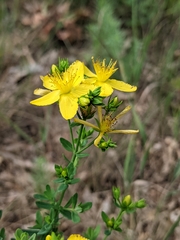


 87 photographs ›
At a glance
- Jan
- Feb
- Mar
- Apr
- May
- Jun
- Jul
- Aug
- Sep
- Oct
- Nov
- Dec
Hardiness of the habitat
| USDA zone of the habitat | 6a | the mean of the typical spot’s lowest night in each of 44 complete years, 1981–2024: −22.0 °C = −22.0 × 9 ÷ 5 + 32 = −7.6 °F, in zone 6a (−10 to −5 °F). USDA’s zones are the 30-year mean of each year’s lowest temperature, in 10 °F zones with 5 °F half-zones (USDA Plant Hardiness Zone Map); this mean is of the years the series holds, not USDA’s 1991–2020. |
|---|---|---|
| RHS band of the record low | H7 | the record low falls in RHS’s H7 band (colder than −20 °C: very hardy; RHS hardiness rating): −29.3 °C, the lowest night in 44 years. |
Both are the habitat’s, worked out from where it grows wild: neither is a tested hardiness of the plant. Lows from NASA POWER (MERRA-2) daily 1981–2024, cell 43.00_76.875, lapse-corrected -861 m at 6.5 °C/km.
Climate class
Dfb Köppen–Geiger, worked out from the median year of the range’s 780 cells
| D cold | the coldest month −8.3 °C, 0 °C or under; the warmest 18.8 °C, over 10 °C; not arid: 639 mm a year, 10 × 23.8 mm (2 × 4.9 + 14: 57% of the rain in summer and 43% in winter, neither 70% or more) or more |
|---|---|
| f without dry season | neither: the driest summer month 38 mm against the wettest winter month's 60 mm, the driest winter month 34 mm against the wettest summer month's 78 mm (summer April to September) |
| b warm summer | the warmest month under 22 °C, 5 months over 10 °C |
By the thresholds of Peel, Finlayson and McMahon (2007), Hydrology and Earth System Sciences 11, 1633–1644, Table 1; summer is the warmer of October to March and April to September. The class of the median year, each month’s median across the cells, not of each cell.
Walter–Lieth: no arid month: every month’s rain in mm is at least twice its mean temperature in °C. The scale of Walter and Lieth’s climate diagrams (1960–1967), 10 °C to 20 mm.
The months read: CHELSA V2.1 1981–2010 climatology, 0.05° cells (each the mean of ~36 1 km pixels).
At home, aim for (worked out from the figures above)
| Winter nights | -20–-4 °C | the January mean nightly low, 10th to 90th percentile across the 780 cells of the range, median -11.2 °C (CHELSA V2.1, 1981–2010); its coldest night on record was -29.3 °C (NASA POWER, daily lows over 44 years at the typical spot) |
|---|---|---|
| Summer days | 20–25 °C | the July mean daily high, 10th to 90th percentile across the 780 cells of the range, median 22.9 °C (CHELSA V2.1, 1981–2010) |
| Grow light, 14 h a day | 379 µmol/m²/s | the year’s mean daily light, 19.1 mol/m²/day (the twelve monthly medians averaged; open sky, CHELSA V2.1, 1981–2010 solar radiation at 2.07 mol of PAR per MJ), × 1,000,000 ÷ (14 × 3,600) |
| Humidity | 55–70% | the lowest and highest of the twelve monthly median relative humidities (CHELSA V2.1, 1981–2010); a figure about the air, saying nothing of how the plant takes water |
A starting point worked out from where it grows wild, not tested in cultivation. The light is the open sky’s; a plant among rocks or shrubs gets less.
Summary
Hypericum perforatum, commonly known as St. John's wort (sometimes perforate St. John's wort or common St. John's wort), is a flowering plant in the family Hypericaceae. It is a hairless, perennial herb with woody roots, yellow flowers marked by black glands, and leaves that appear perforated due to translucent glands, producing thousands of seeds per plant.
Quoted from Wikipedia, "Hypericum perforatum", its opening paragraph, revision 1375575520, read 2026-11-19, CC BY-SA 4.0.
About the genus · Hypericum
Hypericum is a genus of flowering plants in the family Hypericaceae (formerly considered a subfamily of Clusiaceae). The genus has a nearly worldwide distribution, missing only from tropical lowlands, deserts and polar regions. Many Hypericum species are regarded as invasive species and noxious weeds. More on Wikipedia ›
Quoted from Wikipedia, "Hypericum", its opening paragraph, revision 1354820641, read 2026-11-08, CC BY-SA 4.0.
Cultivation
Seasons
The rain rule reads no short rainy season: 70% of the median year's rain (491 mm of 639 mm) takes 8 months, May to December. Mean temperature moves 27.1 °C between the warmest and coldest month. Months are the habitat's, northern hemisphere; shifted six months for a southern-hemisphere collection: November to June.
Rain
639 mm in the median year at the habitat, 491 mm of it May to December. Wettest month July at 78 mm, driest months (2 at 34 mm). Across the grid cells of the range the year's total runs 507 mm to 1,002 mm, the 10th to 90th percentile of each cell's own year. The median of the cells' own yearly totals, 641 mm, is the year's rain at the top of the page; the 639 mm here is the median year's, the twelve monthly medians added, which the rain rule reads. Habitat calendar, northern hemisphere; median year across the grid cells of the range, CHELSA.
Light
Open sky over the habitat: 3 to 37 mol/m²/day across the year (daily light integral, median year across the grid cells of the range, CHELSA; the lowest 10th-percentile month across the cells is 1, the highest 90th-percentile month 41).
Warmth and air
Coldest: the 1st-percentile night over 44 years at a typical spot in the range is -19.8 °C, the absolute minimum -29.3 °C, 6,441 frost nights in 44 years, 146.4 a year (NASA POWER daily minima). Warmest: the 99th-percentile day is 30.1 °C. Monthly means: the coldest month's mean nightly low -11.2 °C in January and February (across the grid cells of the range -19.5 °C to -3.6 °C), the warmest month's mean daily high 22.9 °C in July (median year across the grid cells of the range, CHELSA). Cold floor: -19.8 °C, which is the 1st-percentile night over 44 years at a typical spot in the range (NASA POWER).
Relative humidity at the habitat: 55 to 70% across the year (monthly means, median year across the grid cells of the range, CHELSA). A figure about the air, saying nothing about how the plant takes water.
How this section is made
Each card states this species' habitat figures with their sources, and what two fixed rules read from them; nothing here says what the plant does, wants or tolerates. The rules · the terms.
Seasons. Read from the median year of CHELSA monthly rainfall and mean temperature across the grid cells of the range: the rain rule takes the smallest set of months carrying 70% of the rain and calls it winter when its mean is more than half a degree below the year's, summer when more than that above, and neither in between; the temperature rule, used only under 120 mm, names the cooler six months when they are at least a degree cooler than the other six. Months are shifted for the other hemisphere only where the temperature curve moves 4 °C or more and the habitat lies 10° or more from the equator. A reading of the curves, not an observation of the plant.
Rain. CHELSA monthly precipitation, median year across the grid cells of the range. The rain that falls where the species is recorded; nothing about how the plant takes water.
Light. CHELSA shortwave radiation at each envelope cell, a daily-mean flux taken to a daily total and converted at 2.07 mol of PAR per MJ. The sky over the habitat, measured; what reaches a plant under a rock, a shrub or a shade cloth is not.
Temperature. NASA POWER daily minima and maxima over 44 years at a typical spot in the range, lapse-corrected -861 m to its elevation; CHELSA monthly means, median year across the grid cells of the range. The cold floor is the 1st-percentile night named in its sentence. Not a measured survival limit for any plant in a pot.
Humidity. CHELSA relative humidity, median year across the grid cells of the range.
Climate across the habitat
Habitat months, northern hemisphere
Mean daily high from -5 °C in Jan and Feb to 23 °C in Jul; mean nightly low from -11 °C in Jan and Feb to 14 °C in Jul. The cold quarter, Dec to Feb, is the three months around the coldest month's mean nightly low, centred on the 2 months in a row that tie for it. 639 mm of rain in the median year (the twelve monthly medians added), the wettest month Jul. The bands show the 10th to 90th percentile across 780 habitat cells. Over 44 years at a typical spot in the range (NASA POWER) the absolute minimum was -29.3 °C and the 1-in-100 hot day (the 99th-percentile day) 30.1 °C; neither is dated to a month. Beneath: daily light integral and relative humidity through the year, each on its own scale.
Figures by month
| Month | Day °C | Night °C | Rain mm | DLI | RH % |
|---|---|---|---|---|---|
| Jan | −5 / −12–1 | −11 / −20–−4 | 42 / 27–75 | 4 / 2–10 | 69 / 60–74 |
| Feb | −5 / −10–1 | −11 / −18–−4 | 34 / 22–58 | 10 / 7–17 | 67 / 59–71 |
| Mar | 1 / −3–5 | −6 / −11–−2 | 34 / 23–70 | 19 / 14–26 | 63 / 58–65 |
| Apr | 9 / 6–11 | 0 / −4–3 | 38 / 31–77 | 28 / 25–34 | 58 / 55–60 |
| May | 16 / 14–18 | 7 / 4–8 | 48 / 38–96 | 35 / 33–38 | 55 / 53–58 |
| Jun | 21 / 18–23 | 11 / 10–13 | 70 / 56–96 | 37 / 34–41 | 57 / 54–60 |
| Jul | 23 / 20–25 | 14 / 12–16 | 78 / 58–105 | 35 / 33–39 | 59 / 56–61 |
| Aug | 21 / 19–23 | 13 / 11–14 | 70 / 47–99 | 28 / 25–34 | 60 / 56–62 |
| Sep | 15 / 14–18 | 8 / 5–10 | 58 / 43–91 | 18 / 16–25 | 61 / 56–63 |
| Oct | 8 / 6–11 | 3 / −2–6 | 60 / 45–109 | 9 / 8–17 | 63 / 58–67 |
| Nov | 0 / −4–6 | −5 / −11–1 | 56 / 40–98 | 4 / 3–10 | 68 / 59–70 |
| Dec | −4 / −10–2 | −10 / −17–−2 | 51 / 33–76 | 3 / 1–8 | 70 / 60–73 |
How this section is made
Natural habitat
Flowering by month
- 303Jan
- 159Feb
- 72Mar
- 44Apr
- 266May
- 1727Jun
- 2302Jul
- 946Aug
- 326Sep
- 97Oct
- 114Nov
- 210Dec
Flowering observations of wild plants on iNaturalist, as iNaturalist shares them with GBIF: GBIF.org (2026-11-15) GBIF Occurrence Download https://doi.org/10.15468/dl.y8zpkp: 6566 observations, research grade, openly licensed (CC0, CC BY or CC BY-NC), counted under the page's GBIF keys. Calendar months, as each plant was observed; not moved to your hemisphere.
How this section is made
Photographs
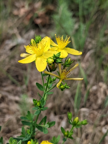
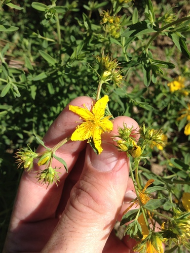
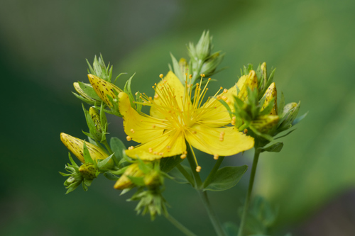
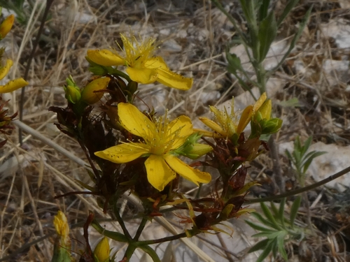
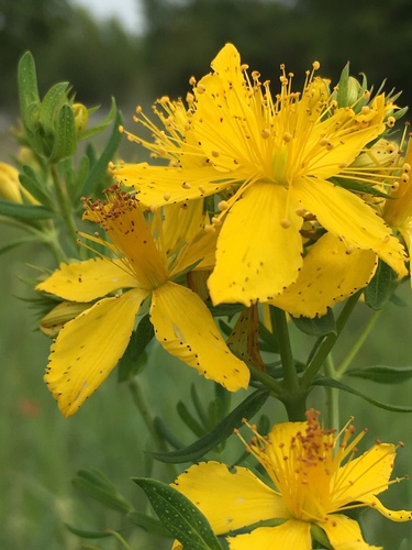
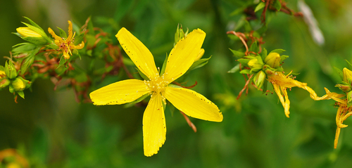
The photograph at the top: (c) Ivan Wiljanen, some rights reserved (CC BY), observed growing wild, observed 2021-06-19. Photographs: (c) Alan Prather, some rights reserved (CC BY); (c) Justin Johnsen, some rights reserved (CC BY); (c) Ivan Wiljanen, some rights reserved (CC BY); (c) Martin Scheuch, some rights reserved (CC BY); (c) Georgios Mesimeris, some rights reserved (CC BY-SA); (c) Gordon Johnston, some rights reserved (CC BY-SA). Credits as read from iNaturalist on 2026-11-19. What each licence allows.
Related
Similar habitat climate The 6 nearest by mean daily high, mean nightly low and rain, month by month. How.
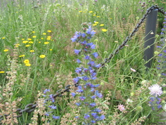 Echium vulgare Viper's-bugloss Photo: CC BY, Oleksandr Shynder
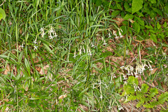 Silene nutans Nottingham catchfly Photo: CC BY, Drepanostoma
 Poa angustifolia Narrow-leaved meadow-grass Photo: CC BY, Patrick Hacker
 Agrostis stolonifera Creeping bent Photo: CC BY, Julia Palmer
 Persicaria lapathifolia Curlytop knotweed Photo: CC0, Daniel Atha
 Rosa spinosissima Scotch rose Photo: CC0, Игорь Загребин
Other Hypericum 106 in the reference
 Hypericum adpressum Creeping St. Johnswort Photo: CC BY, Ryan Sorrells
 Hypericum aegypticum Egyptian St John's wort Photo: CC BY, Ruben Ciantia
 Hypericum aethiopicum African St Johns Wort Photo: CC BY-SA, Tony Rebelo
 Hypericum anagalloides Tinker's-penny Photo: CC BY, Nolan Exe
 Hypericum androsaemum Tutsan Photo: CC BY, DeeF
 Hypericum annulatum Hypericaceae Photo: CC BY-SA, susan brown
 Hypericum ascyron Great St. John's-wort Photo: CC BY, Andrew Conboy
 Hypericum athoum Hypericaceae Photo: CC BY-SA, peganum from Henfield, England
 Hypericum balearicum Majorca St John's wort Photo: CC BY-SA, Grzegorz Grzejszczak
 Hypericum bellum Hypericaceae Photo: CC BY-SA, Nick all 107 ›
Names & registers
Also known as Hypericum perforatum f. floribundum. (GBIF Backbone)
WFO Plant List (2026-06) accepted. World Flora Online, CC0; read 2026-11-13.
Published in Sp. Pl.: 785 (1753) (WCVP, RBG Kew, file of 2026-06-04)
Elsewhere Tropicos · Catalogue of Life · Red List of South African Plants · NatureServe · Flora of North America · Flora of China · USDA PLANTS · Calflora · Reflora · Flora of Australia · APNI · FloraBase · VicFlora · NSW Flora · Missouri Plant Finder · CalPhotos · EOL · ITIS · NCBI (identifiers from Wikidata's item Q158289, read 2026-11-13, CC0)
Chromosomes 2n = 32 (Probatova et al. 2009, Hill 1989, Löve & Löve 1982, Van Loon & Snelders 1979, Van Loon & Kieft 1980, Van Loon & Jong 1978, Erst et al. 2016, Kapoor 1982); 2n = 16 (Papanicolaou 1984); n = 16 (Jeelani et al. 2011, Kaur & Singhal 2012). ChromoDB, IAPT/IOPB chromosome data (Simon, Bosch & Blanché), version 3.1 of 8 November 2026, CC BY 4.0; read 2026-11-13.
The record
Predicted extinction risk 1% probability of being threatened (95% interval 0% to 1%); predicted not threatened, the model is confident of this class. A model's prediction, not an assessment. Bachman et al. 2024, New Phytologist; Kew's data of 1 February 2024, CC BY 4.0; read 2026-11-13.
CITES Not in the CITES Appendices (the edition in force from 5 March 2026): no listing of its name, its genus or its family. CITES Appendices I, II and III, valid from 5 March 2026; read 2026-11-13. The Appendices
Every figure here is derived from public data by a stated rule and names its source; nothing about this species is written for its page by a person or by AI, apart from the marked, credited quotations. How →
Where this page came from built 2026-11-19
gbif.species answeredasked 2026-11-19gbif.synonyms answeredasked 2026-11-19gbif.vernacular answeredasked 2026-11-19names fetched 2026-11-19wcvp.distribution answeredas of 2026-06-04gbif.occurrences answeredasked 2026-11-19GBIF occurrence search API; records tested against the native regions' shapes, openly licensed and restricted alike (Natural Earth's provinces, placed in TDWG's regions; shapes rule r87); a record within the margin, off a coast or on an island too small to draw counted only when it states the region's country, and only on no other region's land but within 0.02° of a native shape across a border, where its stated state or province does not name the other region (read by Natural Earth's name, its ISO 3166-2 code or an old province's name); 40 records within 1 km of a botanic garden, herbarium or zoo left out (39 at a botanic garden or arboretum, 1 at a zoo; Wikidata's list)climate answeredasked 2026-11-19climate.extremes answeredasked 2026-11-19NASA POWER (MERRA-2) daily 1981–2024, cell 43.00_76.875, lapse-corrected -861 m at 6.5 °C/kmwikidata answeredasked 2026-11-19wikipedia answeredasked 2026-11-19inat.taxon answeredasked 2026-11-19iNaturalist's taxon 56077 (Hypericum perforatum), as Wikidata gives it, is activeinat.photos.wild answeredasked 2026-11-19from iNaturalist's API: research-grade observations not marked captive with an open-licence photograph, the observations iNaturalist puts first by votes, 24 of them (the open data of 2026-09-27 holds 10013, and no votes)inat.photos.cultivated answeredasked 2026-11-19observations marked captive or cultivated whose identifications agreegbif.media answeredasked 2026-11-19openalex not askedthe reference does not ask OpenAlex for papersEvery source is recorded as having answered, reported nothing, refused, failed, not been asked, or answered twice where one answer is taken (“not taken: two items answered”), and, for a source asked when this page was built, when: the figures are as the source held them that day; a source read from a file (Kew's World Checklist, a GBIF download) says "as of" the file's day instead; a row carried from an earlier build of the page names that build instead. Only “nothing to report” is ever shown as an absence. Records came from 21 datasets via GBIF.org; each carries its own licence.